Following in the footsteps of Théodore Monod (15 days including 13 days of walking).
This tour is an exceptional excursion through one of Mauritania's most beautiful regions; this area is also considered a veritable open-air museum. We will travel from Aderg to Ouadane, passing by the largest Paleolithic site in Mauritania (El Beyed), then Guelb Er Richat (a true geological enigma), Agouieidir, and more.
This tour can be started from Ouadane.
Highlights: Ouadane - El Beyed - Chemchame - Aderg - Guelb Er Richat - rhythm of the camel caravan - Bivouacs.
YOUR TRIP
J 1 Paris - Atar
Departure from Paris (charter flight) to Atar, meal and overnight stay at the Auberge du Bonheur.
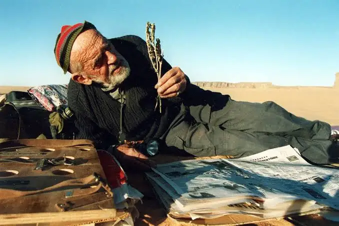
J 2 Atar - La sebkha Chemcham - puits de Neytiri
We leave the paved road at the northeastern exit of the city of Atar and take tracks, sometimes sandy, in the foothills of the Adrar Mountains. We visit the medieval house (built around 1480) and the tomb of Mauritania's greatest religious leader. Then we cross (on dry land) the large Paleolithic lake of Chemcham and arrive around noon at the Neytiri well, our meeting point with our camel team.
The camel trek departs in the early afternoon towards the Aderg inselberg, crossing a reg (stony desert) dotted with barchans (rocky outcrops).
We camp in the dunes at the foot of the guelb (rocky outcrop).
J 3 Neytiri - Aderg
Hike in the Makteir and ascent of the Aderg inselberg. Return to the bivouac for a picnic. Short walk in the afternoon and bivouac in the erg north of the inselberg.
J 4 Aderg - Bouguerba
We leave the erg, which we skirt on foot along a flat reg, heading towards Hassi Bouguerba.
Bivouac.
J 5 Bouguerba - Tazazmout
We continue our trek, northeast, still on the stony plain towards the Tazazmout headland.
Bivouac
J 6 Tazazmout - Lekneibess
Heading due east, we continue our journey between the Makteir erg and the Adrar plateau.
Overnight camp at Lekneibess.
J 7 Lekneibess - El Beyed
Early departure for El Beyed, where we arrive around noon. We set up camp on a dune north of the village, very close to the well. We visit the Museum of Prehistory and the rock art site. We meet the semi-nomadic inhabitants of El Beyed.
Camp
J 8 El Beyed - Oued N'mour
Departure towards the N'mour wadi, due south. After ascending the Thnaya pass, the Azilal plateau unfolds on the horizon.
Bivouac at the N'mour wadi.
J 9 Oued N'mour - Tililit
We continue our journey across the reg, following a southeast axis, and take a steep camel trail that leads us to the Tililit spring. Rock engravings are a site here.
Bivouac.
J 10 Tililit - Camp boisé (Guelb Er Richat)
From Tililit, we set off for Guelb Er Richat, crossing the Akerdeil plain to reach the first "richat" (wing), a circular mountain of the Guelb. We camped in the center of the Guelb near the "wooded camp" nicknamed "The Diocese of Théodore Monod."
Guelb Er Richat is an exceptional geological site, nicknamed "the Eye of the Earth" or "the Eye of Africa."
A true geological enigma, long considered to be the impact of a giant meteorite, this collection of concentric ridges is truly remarkable!
The most widely accepted explanation is that a magmatic dome formed at the intersection of fault lines approximately one hundred million years ago and stopped growing before it could become a volcano. The ancient Cambrian sandstones, uplifted by the formation of the dome, were subsequently subjected to fractures and erosion, resulting in the concentric cuesta system that gives the Richat massif its somewhat mysterious character today. After initially interpreting it as an astrobleme (a meteorite impact crater), geologists considered the possibility of symmetrical uplift (a circular anticline). However, Th. Monod, who studied this phenomenon with several colleagues, published hypotheses nearly half a century ago (Monod and Pomerol, 1973) that closely resemble the explanation commonly accepted today. Thus, since around 1980, it has been accepted that the Richat structure is that of an “alkaline complex” resulting from a particular form of volcanism dating back 100 million years (Cretaceous: end of the Mesozoic Era) which created a magmatic dome associated with hydrothermal activity (circulation of very hot water under very high pressure). The formation of this complex occurred during the opening of the Atlantic Ocean.
J 11 Richat (camp boisé) - Agoeuidir
Still heading due south, we leave the "wings" via a pass towards Hassi Dhiba (the jackal's well) on the southern edge of Guelb Er Richat. We camp near the ruins of the Portuguese fort of Agouieidir (which some attribute to the Moroccan sultans who kept a watchful eye on the prosperous caravan town of "Ouadane").
J 12 Agoeuidir - Mayeeteg
We continue our trek through the beautiful dunes of Erg Ouarane, still heading due south towards the Mayaateg depression.
We camp near the Mayaateg palm grove.
J 13 Mayeeteg - Ouadane
From Mayaateg, we head towards the historic town of Ouadane, northwest of Mayaateg. Ouadane means "the two wadis" (two valleys): the wadi of science, which is the town's name due to the number of scholars there, and the wadi of dates. Ouadane is the town that introduced the date palm to Mauritania approximately 1400 years ago, and it boasts more than eighty varieties of date palms!
J 14 Ouadane – Atar
Visit to the old town of Ouadane.
Departure for Atar in the early afternoon. Overnight stay at the guesthouse.
J 15 Flight to France.
